Trails
The following trails are within a relatively short driving distance (1 hour or less) of Athens, GA. Some of these trails are partially maintained by SORBA Athens.
Overview
Here is an overview map of the trails listed below. For more detailed information, including recommended parking spots, check the entry for each trail below.
In-town trails
In addition to the trails described below, there are other trails in and around Athens that folks ride regularly. However, those trails are not officially designated as MTB trails, and we therefore don’t list them here.
Walker Park
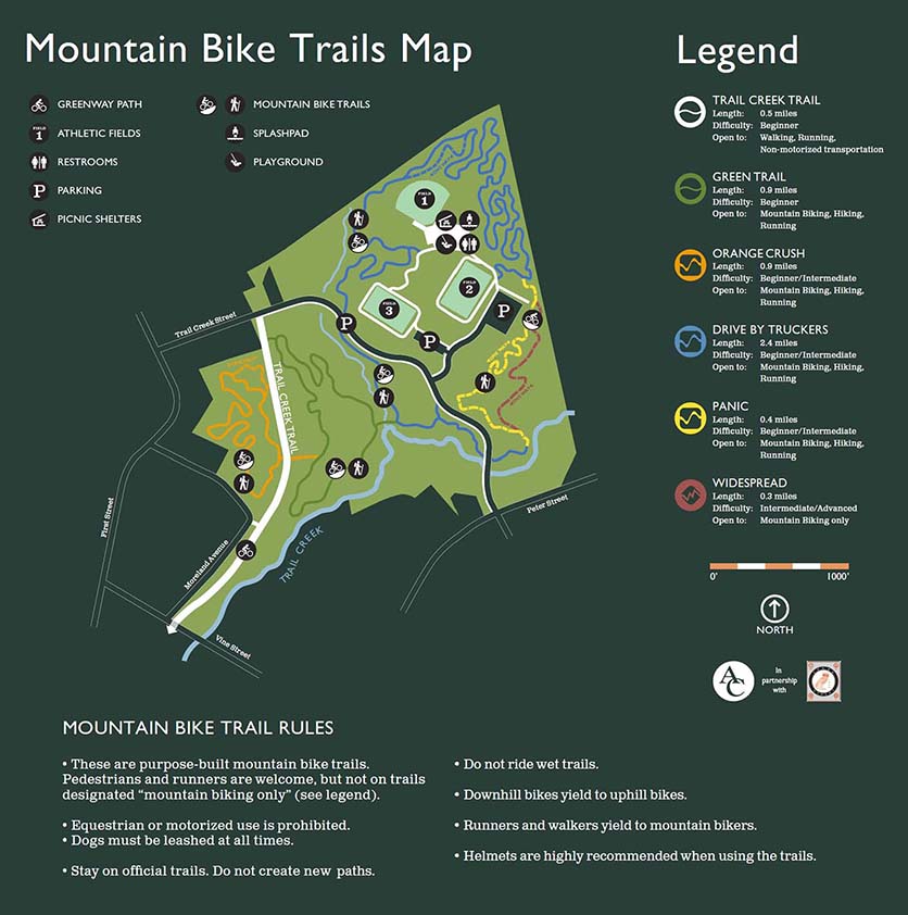
Walker Park offers just under 5 miles of trails which include beginner, intermediate and advanced trails and offers something for all skill levels.
UGA Intramural Fields
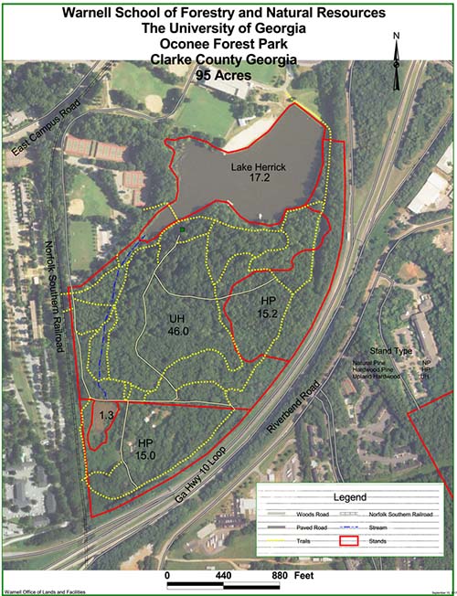 The UGA intramural fields and the adjacent wooded area called Oconee Forest Park have a few miles o trails. Open sunrise to sunset. Hikers and dog walkers share this trail and are usually present in great numbers. Bikes are not allowed on some sections, look for the “No Bikes” symbol and respect them.
Okonee Trail
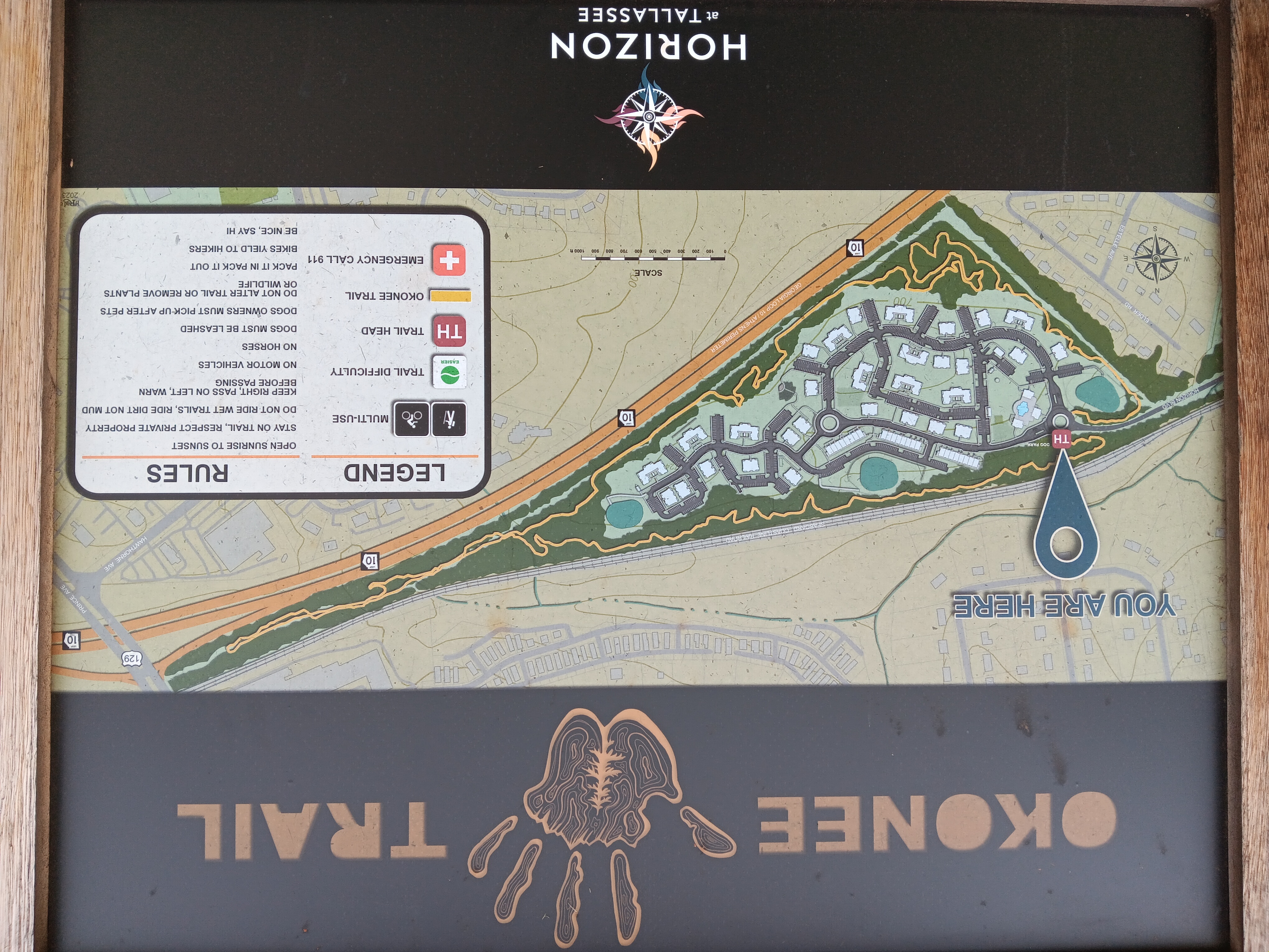
The Okonee trail is around 2 miles long and loops around the Horizon at Tallassee apartment complex. Currently, the trail doesn’t have an official website.
- Trails map on Trailforks
- Google maps link for the trail head. Note that this is the entrance of the gated apartment complex. Usually the gates are open and one can park in one of the many spots.
Athens Academy Trails
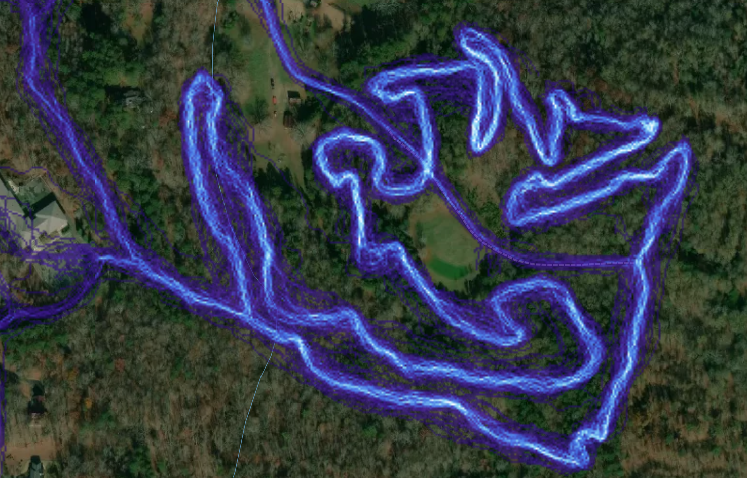 Athens Academy has about 3 miles of trails on their property that are open to Mountain Biking. There is currently no trailforks map, but the trail is fairly well marked.
- Google maps link for the parking area - this is one of the school parking lots, you are allowed to park there after hours. The start of the trail is right next to the parking lot.
Trails around Athens
The trails below are within a maximum of about an hour driving from Athens (depending on which side of town you are on). SORBA-Athens is involved in some of the trails.
Heritage Park
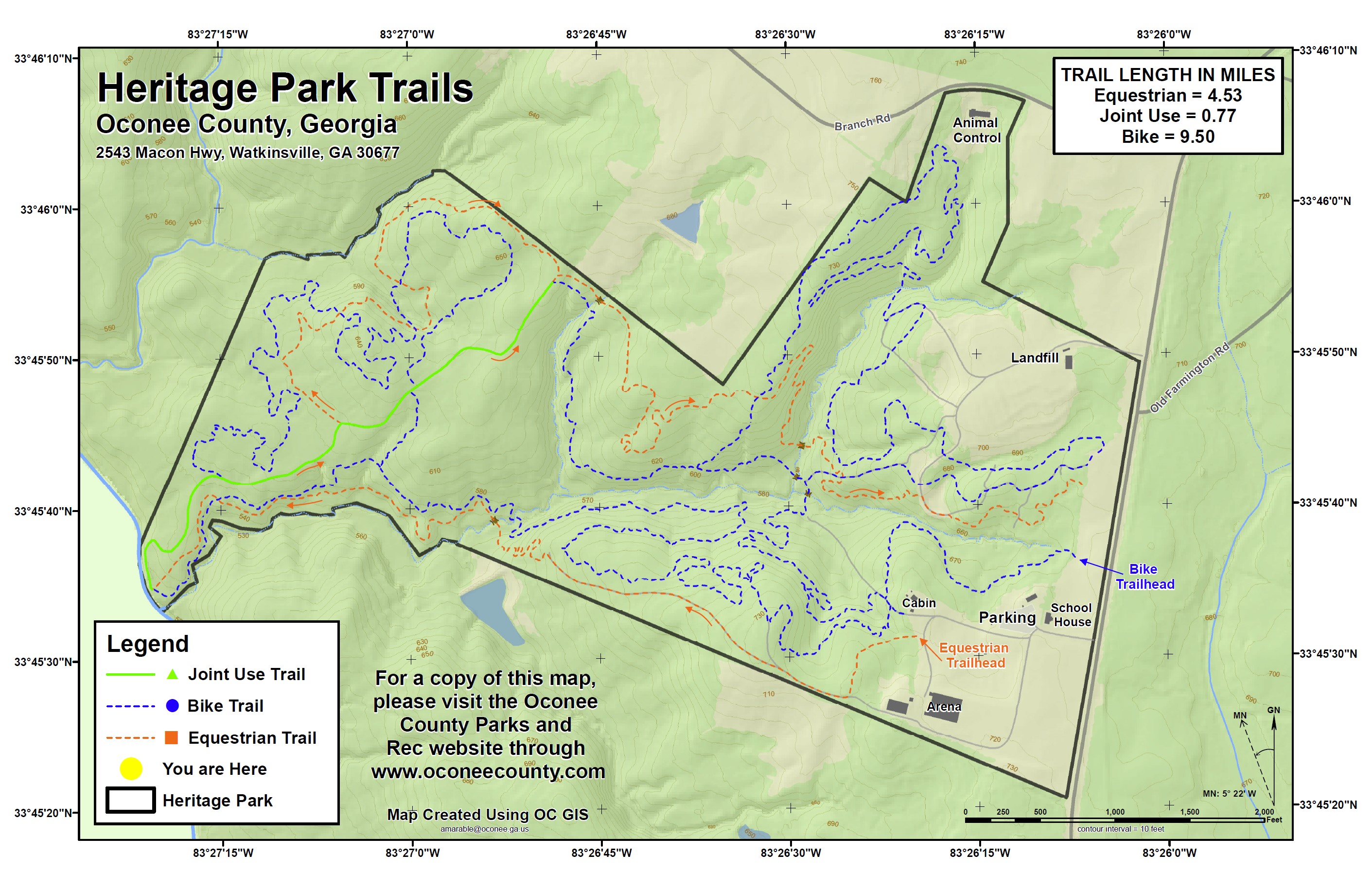 Heritage Park is a county park in Oconee county. It has 10 miles of trails (Intermediate / Advanced). Open sunrise to sunset. There are separate trail sections for bikes and horses. When the trails are officially closed by Oconee County there will be an announcement posted on the Trail Status Link above. Heritage is a challenging old school trail with some tight twisty singletrack, challenging climbs, fast downhills, and technical sections with roots and rocks.
Hart Farm
 Hart Farm Trails is a trail system in Union Point. It consists of a hand-cut single track that bisects a power line easement. There is currently a 9-mile loop flagged with white markers. Trails pop in and out of the woods and you are never far from the trailhead, which has a covered picnic area, camper restroom, and a bike wash station.
Hawkes Creek Farm
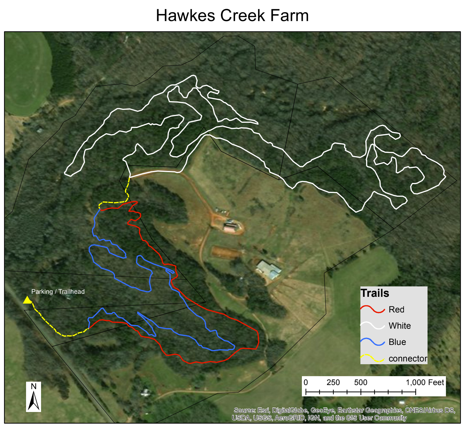 About 4 miles of trails between Arnoldsville and Colbert, east of Winterville.
Fox Trails
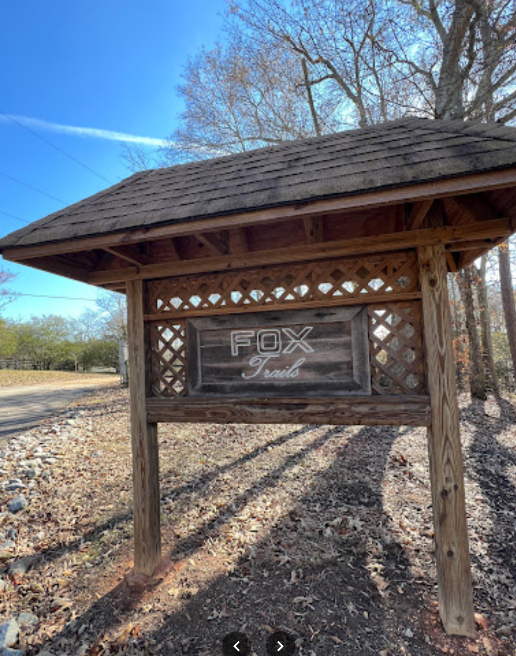
Four miles of trails just outside of Commerce.
Chicopee Woods Mountain Bike Trails
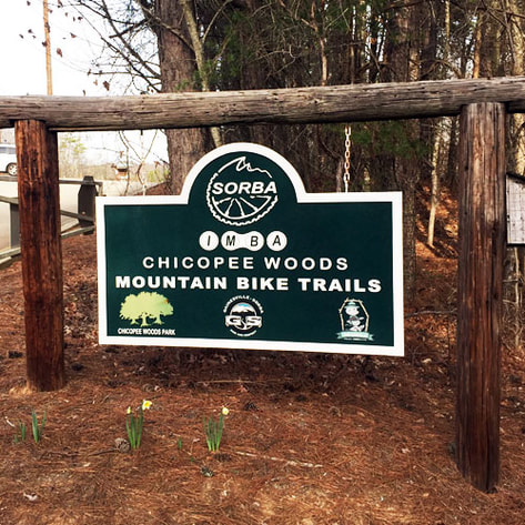
This trail system is located just south of Gainsville. It offers 21 miles of trails. E-bikes are not allowed. There is a parking fee, which supports the upkeep of the park and trails.
Harbins Park
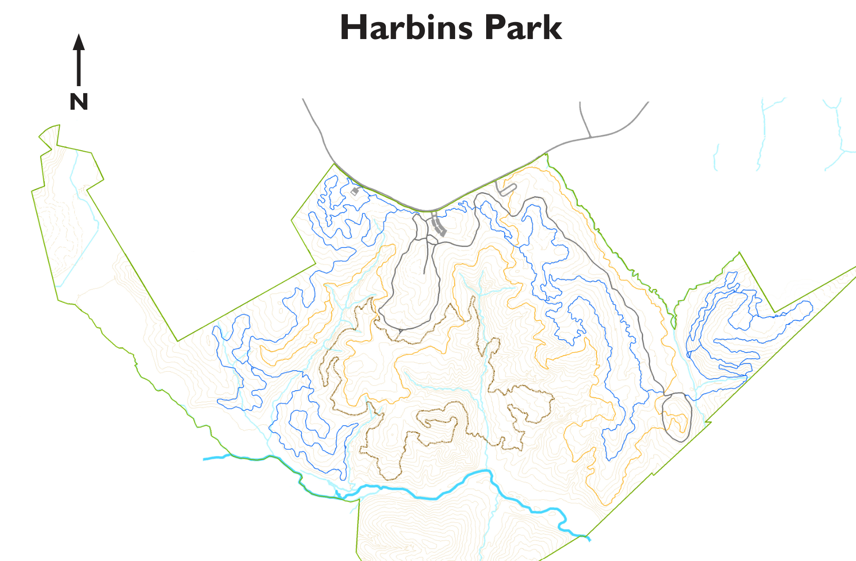
To the west of Athens, a little bit further than Fort Yargo (about 45 minutes) is this Gwinnett County park with around 13 miles of mountain bike trails. There is also a several mile long paved trail, which connects to Tribble Mill park to the West, another Gwinnett County park with more mountain bike trails.
Tribble Mill Park
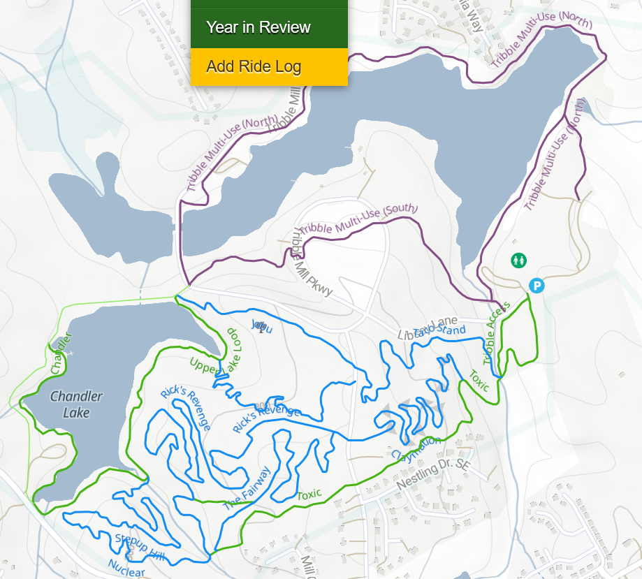 Just a few miles west of Harbins Park, and connected to it by the paved Harris Greenway trail, this is another Gwinnett County park. It has around 10 miles of trails, some paved, some off-road.
- Official website
- Trails map on Trailforks
- Google maps link for the parking area - this is just one of multiple parking areas. This one has bathrooms and some of the trails start right behind the parking lot.
Fort Yargo State Park
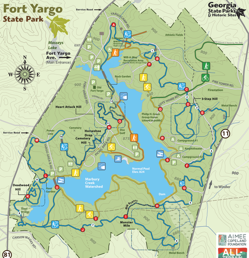
This state park is a little over 30 minutes west of Athens. It has over 20 miles of trails, mainly in the form of two loops around the lake, a shorter inner loop and a longer outer loop.
- Official website - the website also has a link to a trail map.
- Trails map on Trailforks
- Google maps link for the parking area - this is the main parking lot in front of the visitor center. It requires paying to park, either a one-time fee or with an annual state pass.
- Google maps link for alternative parking - this is a parking lot at the Wilkins Greenway trail head, from there one can bike into the park and connect to the trail.
Watson Mill Bridge State Park
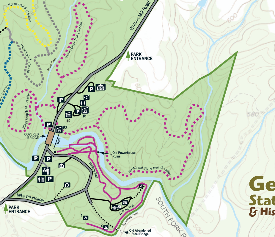
This park is about 30-40 minutes east of Athens. The park offers around 5 miles of trails.
- Official website - it contains a link to the trails map.
- Trails map on Trailforks - as of this writing, not all trails are shown.
- Google maps link for the parking area - this is the parking lot closest to the trails. All other parking areas, including the one closest to the visitor center, are next to each other.
Hard Labor Creek Park
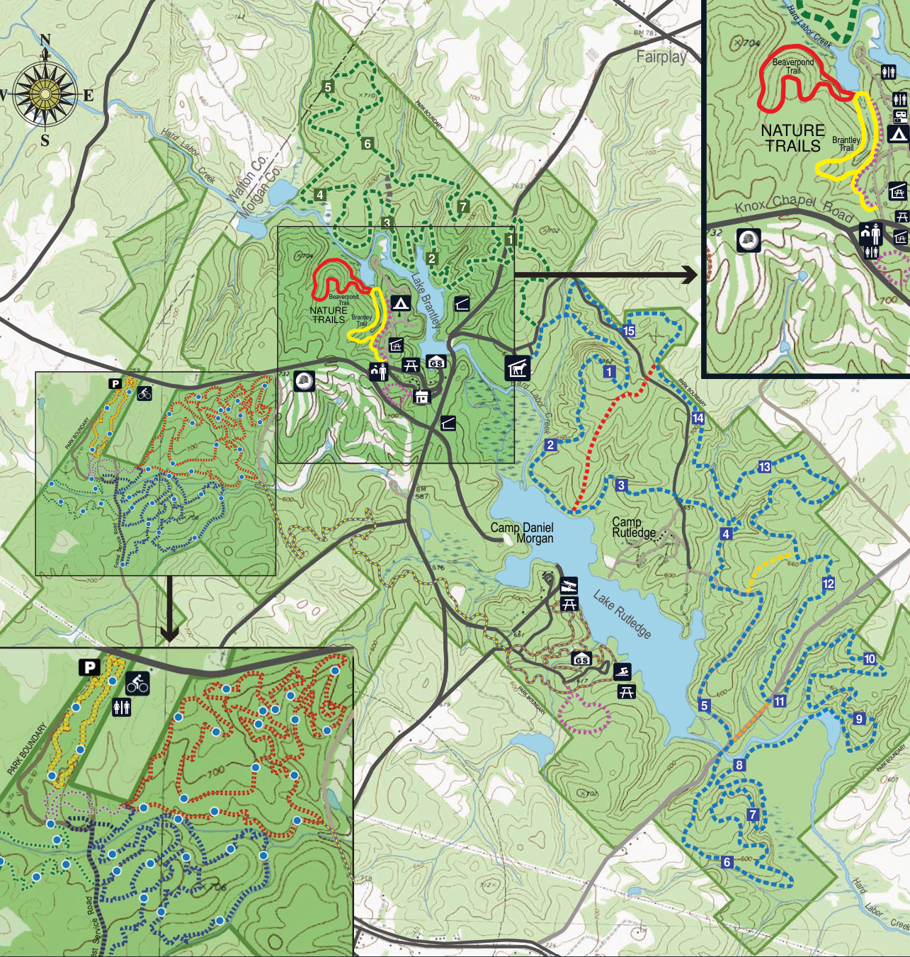
The trails in Hard Labor Creek state park are about 45 minutes south of Athens. The park offers around 16 miles of trails, made up of several shorter loops.
- Official website
- Trails map on Trailforks
- Google maps link for the parking area - this is the parking lot for the trails. It’s not where the mainvisitor center is. Since this is inside the park, it requires paying to park, either a one-time fee or with an annual state pass.